Map every jobsite with clear property context
Turn every property into an interactive map with zones, measurements, notes, assets, hazards, and service context your crews and office can trust.
Give crews and the office a shared map
Data-rich maps preserve property context, clarify service areas, and reduce guesswork.
- Trace Service Zones
- Measure Property Areas
- Give Crews the Same Property Map
- Share Site Details with New Crew Members
- Clarify the Scope of Work
- Keep Mapped Service Boundaries Visible
Map zones, measurements, and property details
Map property context, service zones, and measurements so crews and office staff are not relying on memory, old notes, or paper sketches.
Step 1: Trace & define zones

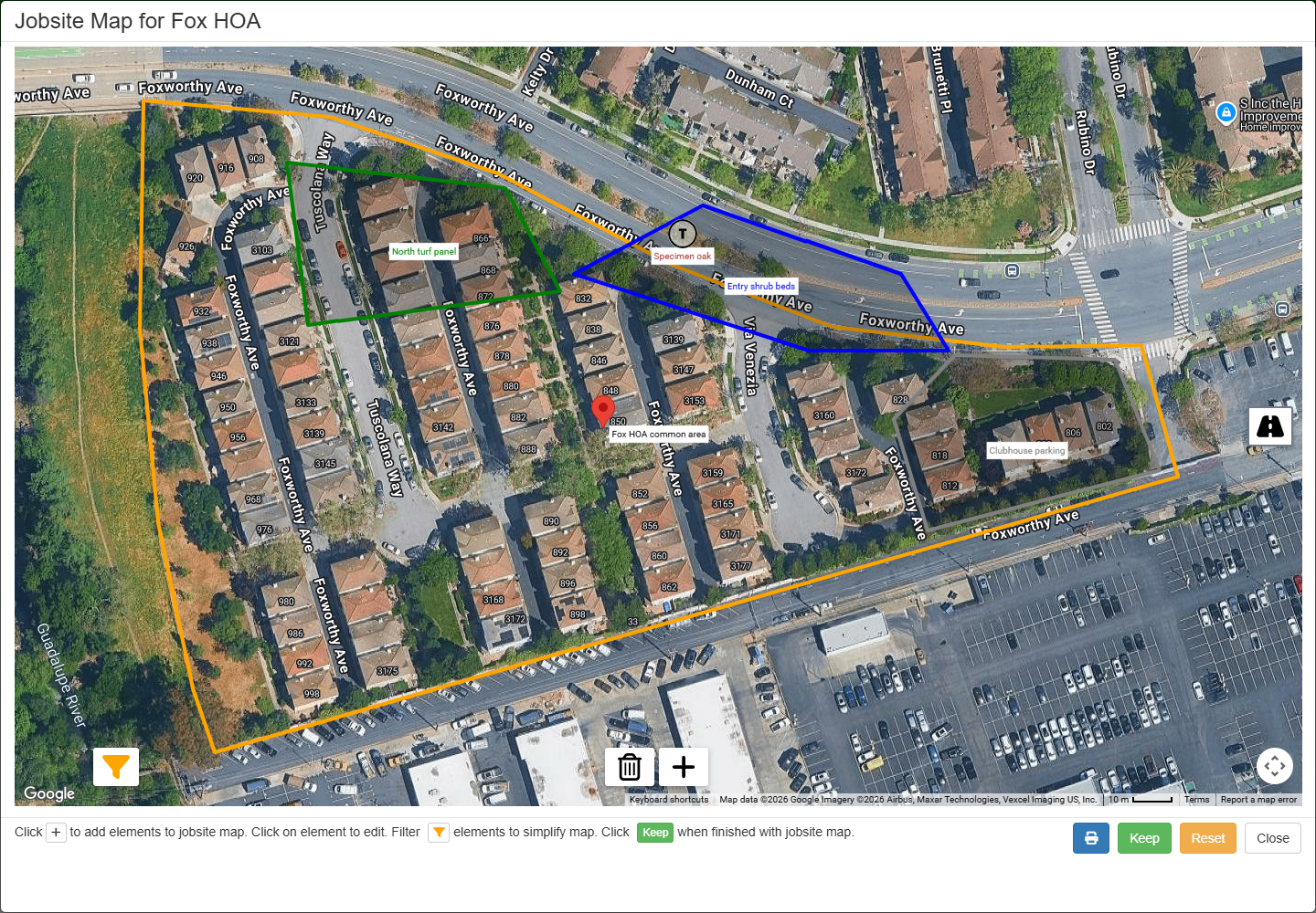
Step 2: Get instant measurements
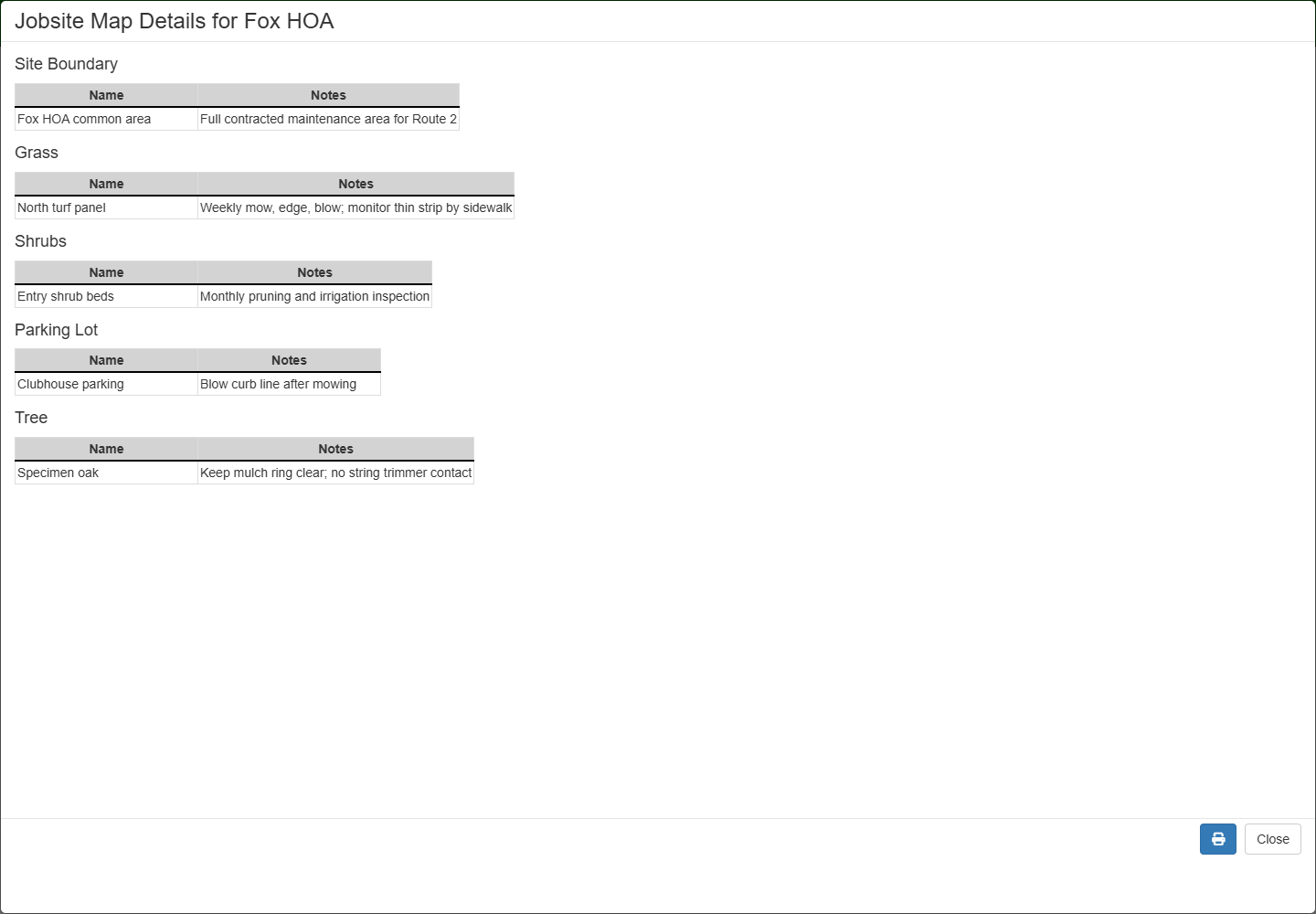
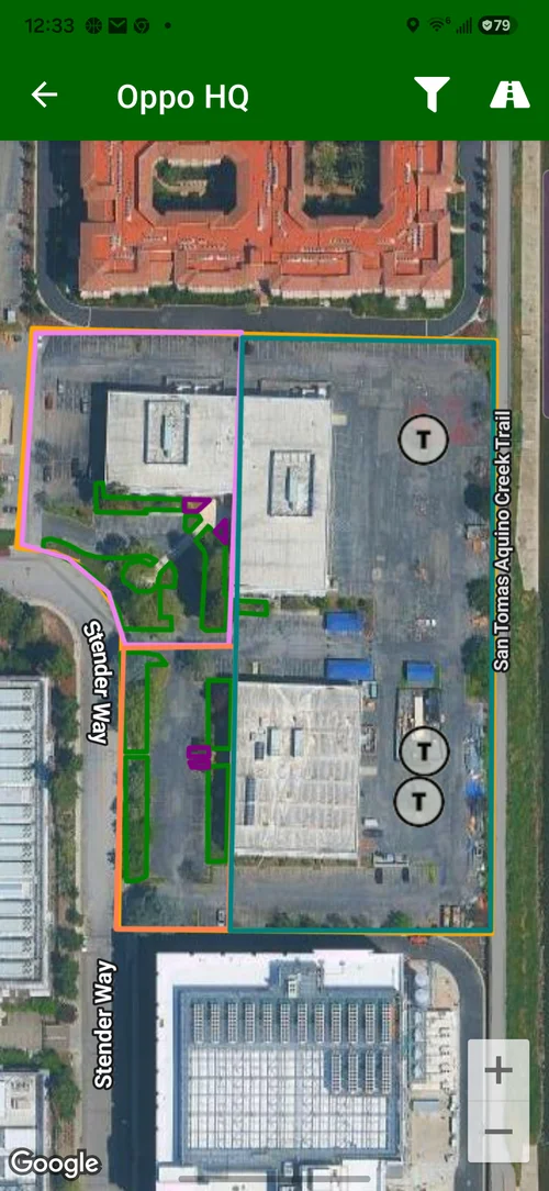
Empower your crews with a clear visual playbook
A confused crew makes mistakes. A confident crew delivers quality. Our mobile maps give your team a clear, visual guide to every property, reducing training time and eliminating guesswork.
- Clarify Scope with Jobsite Boundaries: Show crews the exact property lines and highlight which zones get which service.
- Pinpoint Key Assets & Hazards: Mark the exact location of specific trees, service areas, hazards, or client requests directly on the map.
- Reduce Rework: Clear jobsite context helps crews understand the service area, avoid missed details, and reduce go-backs.
Want to see jobsite context on the map?
Walk through property notes, zones, map context, and the field information crews need before they arrive.
Book a Live Walkthrough